info@chieseromaniche.it
Home
Novità
In evidenza
Il Progetto
Ricerche
Per Comune
Per Provincia
Per Quadrante
Per Itinerario
Per Nome della chiesa
Per Periodo
Per Interesse
Selezioni
Architettura
Campanile
Pittura
Cripta
Risorse
Gallerie Fotografiche
Raccolta Newsletter
Glossario
Agiografia
Documenti
Bibliografia
Sitografia
Mappa Chiese
Mappa Regionale
Mappa Provinciale
Referenze
Elenco Chiese
Referenze fotografiche
Autori Foto
Pubblicare
Contatti
Chiese Romaniche, Gotiche e Rinascimentli nei dintorni
home
Mappa chiese dintorni
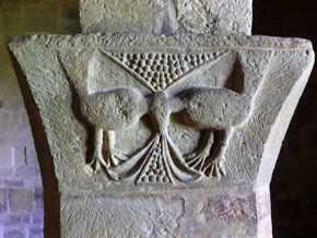
Parrocchiale di San Martino a Pontey
Scegli il raggio in cui cercare le chiese
Seleziona il raggio in chilometri
5
10
15
20
25
30
40
50
60
Parrocchiale di San Martino a Pontey
Elenco chiese nei dintorni
In un raggio di 50 Km
in linea d'aria
San Pietro - CHÂTILLON
(1,9 Km)
Percorso
Scheda
San Maurizio - SAINT-DENIS
(2,7 Km)
Percorso
Scheda
Sant'Erasmo - SAINT-DENIS
(3,1 Km)
Percorso
Scheda
San Lorenzo - CHAMBAVE
(3,3 Km)
Percorso
Scheda
San Vincenzo di Saragozza - SAINT-VINCENT
(4,6 Km)
Percorso
Scheda
San Michele - VERRAYES
(5 Km)
Percorso
Scheda
San Martino e Santa Barba - VERRAYES
(5,3 Km)
Percorso
Scheda
San Martino e Santa Lucia - VERRAYES
(5,3 Km)
Percorso
Scheda
San Maurizio - SAINT-VINCENT
(5,7 Km)
Percorso
Scheda
Saint Germain - MONTJOVET
(6,1 Km)
Percorso
Scheda
Sant'Andrea - ANTEY-SAINT-ANDRÈ
(7,3 Km)
Percorso
Scheda
Santa Maria al Borgo o Na - MONTJOVET
(7,4 Km)
Percorso
Scheda
San Maurizio - FÉNIS
(8,5 Km)
Percorso
Scheda
Saint-Barthélemy - NUS
(10,2 Km)
Percorso
Scheda
Saint-Solutor - ISSOGNE
(10,4 Km)
Percorso
Scheda
San Vittore - CHALLAND-SAINT-VICTOR
(10,6 Km)
Percorso
Scheda
SS. Egidio e Agostino - VERRÉS
(10,8 Km)
Percorso
Scheda
San Gilles o Sant'Egidio - VERRÈS
(10,8 Km)
Percorso
Scheda
San Massimo - CHALLAND-SAINT-VICTOR
(10,8 Km)
Percorso
Scheda
San Maurizio - BRUSSON
(11 Km)
Percorso
Scheda
San Martino - AYAS
(11 Km)
Percorso
Scheda
San Giovanni Battista - CHALLAND-SAINT-ANSELME
(11,5 Km)
Percorso
Scheda
San Maurizio - BRUSSON
(12,5 Km)
Percorso
Scheda
Cimitero - AYAS
(11,1 Km)
Percorso
Scheda
San Martino - ARNAD
(14,3 Km)
Percorso
Scheda
Madonna delle Nevi - ARNAD
(16,5 Km)
Percorso
Scheda
San Giorgio - POLLEIN
(18,3 Km)
Percorso
Scheda
San Giacomo Maggiore - AYAS
(17,4 Km)
Percorso
Scheda
Saint Christophe - SAINT CHRISTOPHE
(18,3 Km)
Percorso
Scheda
Assunzione di Maria - BARD
(18,7 Km)
Percorso
Scheda
Santa Margherita - BIONAZ
(19,9 Km)
Percorso
Scheda
San Pietro in Vincoli - DONNAS
(20,3 Km)
Percorso
Scheda
Priorato di Sant'Orso - AOSTA
(20,7 Km)
Percorso
Scheda
Sant'Orso - AOSTA
(20,7 Km)
Percorso
Scheda
Sant'Orso - AOSTA
(20,7 Km)
Percorso
Scheda
Sant'Orso - AOSTA
(20,7 Km)
Percorso
Scheda
San Lorenzo - AOSTA
(20,8 Km)
Percorso
Scheda
Saint-Bénin - AOSTA
(21 Km)
Percorso
Scheda
Notre Dame de Pitié - CHARVENSOD
(21 Km)
Percorso
Scheda
Santa Caterina - AOSTA
(21 Km)
Percorso
Scheda
San Giacomo Maggiore - ISSIME
(21,2 Km)
Percorso
Scheda
Notre-Dame o Santa Maria - AOSTA
(21,3 Km)
Percorso
Scheda
San Grato - AOSTA
(21,3 Km)
Percorso
Scheda
San Salvatore - PERLOZ
(21,7 Km)
Percorso
Scheda
Notre-Dame-de-le-Garde - PERLOZ
(21,8 Km)
Percorso
Scheda
Fontaney della Beata Verg - PONT-SAINT-MARTIN
(22 Km)
Percorso
Scheda
San Martino - PONT-SAINT-MARTIN
(22,2 Km)
Percorso
Scheda
San Vittore - ROISAN
(22,3 Km)
Percorso
Scheda
San Rocco - LILLIANES
(22,7 Km)
Percorso
Scheda
Saint-Jean de Chevrot - GRESSAN
(22,8 Km)
Percorso
Scheda
San Pantaleone - VALPELLINE
(22,8 Km)
Percorso
Scheda
Saint-Martin de Corleans - AOSTA
(22,9 Km)
Percorso
Scheda
Sant'Antonio Abate - FONTAINEMORE
(23 Km)
Percorso
Scheda
Sant'Orso - COGNE
(23,3 Km)
Percorso
Scheda
Sant'Ilario - GIGNOD
(23,4 Km)
Percorso
Scheda
San Biagio - DOUES
(23,8 Km)
Percorso
Scheda
Sainte-Marie Madeleine de - GRESSAN
(24 Km)
Percorso
Scheda
Sant'Eustachio - SARRE
(24,8 Km)
Percorso
Scheda
Sant'Orso - JOVENÇAN
(24,8 Km)
Percorso
Scheda
San Maurizio - SARRE
(26 Km)
Percorso
Scheda
Santa Barbara e San Nicol - SARRE
(26,5 Km)
Percorso
Scheda
Saint-Léger - AYMAVILLES
(27,8 Km)
Percorso
Scheda
San Pantaleone - OLLOMONT
(26,5 Km)
Percorso
Scheda
San Giovanni - SETTIMO VITTONE
(28,2 Km)
Percorso
Scheda
San Lorenzo - SETTIMO VITTONE
(28,2 Km)
Percorso
Scheda
Vergine e San Giovanni Ev - SAINT-PIERRE
(28,7 Km)
Percorso
Scheda
San Pietro e Paolo - SAINT-PIERRE
(28,5 Km)
Percorso
Scheda
San Giacomo - SETTIMO VITTONE
(29,2 Km)
Percorso
Scheda
Assunta - ETROUBLES
(29,3 Km)
Percorso
Scheda
Santa Maria Maddalena in - CASTELNUOVO NIGRA
(29,6 Km)
Percorso
Scheda
San Giovanni Battista - ALAGNA VALSESIA
(29,6 Km)
Percorso
Scheda
Santa Maria Assunta o Sai - VILLENEUVE
(29,6 Km)
Percorso
Scheda
San Michele - RIVA VALDOBBIA
(29,8 Km)
Percorso
Scheda
San Giovanni Battista - VICO CANAVESE
(30,7 Km)
Percorso
Scheda
Santa Colomba - VILLENEUVE
(29,8 Km)
Percorso
Scheda
San Gregorio - QUASSOLO
(30,8 Km)
Percorso
Scheda
San Germano - BORGOFRANCO D'IVREA
(31,1 Km)
Percorso
Scheda
San Paolo - INTROD
(31,8 Km)
Percorso
Scheda
San Michele Arcangelo - BROSSO
(32,1 Km)
Percorso
Scheda
Santa Maria - ANDRATE
(32,6 Km)
Percorso
Scheda
Sacello Eusebiano - BIELLA
(32,5 Km)
Percorso
Scheda
San Sulpizio - ARVIER
(33,2 Km)
Percorso
Scheda
Santa Marta - BORGOFRANCO D'IVREA
(32,7 Km)
Percorso
Scheda
San Nicola - SAINT-NICOLAS
(32,8 Km)
Percorso
Scheda
Madonna del Carmine - VALSAVARENCHE
(33,8 Km)
Percorso
Scheda
San Martino Vescovo - ALICE SUPERIORE
(34 Km)
Percorso
Scheda
Castello o di Sant'Egidio - MONTALTO DORA
(34,4 Km)
Percorso
Scheda
San Rocco - MONTALTO DORA
(34,4 Km)
Percorso
Scheda
Santi Sebastiano e Rocco - ALICE SUPERIORE
(34,5 Km)
Percorso
Scheda
San Giorgio - RHÊMES-SAINT-GEORGES
(34,9 Km)
Percorso
Scheda
Sant'Eusebio - MONTALTO DORA
(34,5 Km)
Percorso
Scheda
San Michele - PECCO
(34,8 Km)
Percorso
Scheda
Madonna delle Grazie - SORDEVOLO
(34,9 Km)
Percorso
Scheda
San Rocco - SORDEVOLO
(35 Km)
Percorso
Scheda
Cimitero o San Pietro - ISSIGLIO
(35 Km)
Percorso
Scheda
Santa Maria in Doblazio - PONT CANAVESE
(35,1 Km)
Percorso
Scheda
San Brizio - AVISE
(35,2 Km)
Percorso
Scheda
San Giovanni - CINTANO
(35,2 Km)
Percorso
Scheda
Santa Maria delle Rogge - PONT CANAVESE
(35,4 Km)
Percorso
Scheda
Madonna delle Grazie - RIMA SAN GIUSEPPE
(35,5 Km)
Percorso
Scheda
Purificazione di Maria Ve - LUGNACCO
(35,7 Km)
Percorso
Scheda
San Bartolomeo - VISTRORIO
(35,7 Km)
Percorso
Scheda
Santa Croce - SPARONE
(36,1 Km)
Percorso
Scheda
San Francesco - SORDEVOLO
(35,7 Km)
Percorso
Scheda
San Nicolao - BORGIALLO
(36,2 Km)
Percorso
Scheda
Santa Maria Assunta - NETRO
(35,8 Km)
Percorso
Scheda
Santo Stefano di Sessano - CHIAVERANO
(36,3 Km)
Percorso
Scheda
Sant'Eusebio - MUZZANO
(36,4 Km)
Percorso
Scheda
San Giacomo - BORGIALLO
(36,6 Km)
Percorso
Scheda
Tre Re - IVREA
(37,1 Km)
Percorso
Scheda
San Maurizio - IVREA
(37,3 Km)
Percorso
Scheda
Santa Croce - COLLERETTO GIACOSA
(37,7 Km)
Percorso
Scheda
Sant'Urbano o Madonna del - SALERANO CANAVESE
(37,2 Km)
Percorso
Scheda
Santa Maria - IVREA
(37,2 Km)
Percorso
Scheda
Canonici della Catterale - IVREA
(37,2 Km)
Percorso
Scheda
Trinità - SAGLIANO MICCA
(37,2 Km)
Percorso
Scheda
Sant'Ulderico - IVREA
(37,3 Km)
Percorso
Scheda
Sant'Antonio Abate - PILA
(37,7 Km)
Percorso
Scheda
Santo Stefano - IVREA
(37,7 Km)
Percorso
Scheda
Santa Maria Maddalena - BUROLO
(37,8 Km)
Percorso
Scheda
San Pietro - PILA
(38 Km)
Percorso
Scheda
Santo Stefano Protomartir - OCCHIEPPO SUPERIORE
(37,8 Km)
Percorso
Scheda
San Bernardino - IVREA
(38 Km)
Percorso
Scheda
Madonna delle Grazie - CAMBURZANO
(38,3 Km)
Percorso
Scheda
San Lorenzo - ANDORNO MICCA
(38,5 Km)
Percorso
Scheda
Vecchia - MACUGNAGA
(38,6 Km)
Percorso
Scheda
Sant'Antonio Abate o San - SCOPELLO
(38,7 Km)
Percorso
Scheda
San Bernardo - NOASCA
(38,7 Km)
Percorso
Scheda
Madonna di Vespiola - BALDISSERO CANAVESE
(38,9 Km)
Percorso
Scheda
San Giacomo - ALTO SERMENZA
(38,7 Km)
Percorso
Scheda
Madonna del Sasso - BOCCIOLETO
(38,7 Km)
Percorso
Scheda
San Martino o Ciucarun - BOLLENGO
(38,9 Km)
Percorso
Scheda
Madonna del Ponte - BOCCIOLETO
(38,8 Km)
Percorso
Scheda
Sant'Orso - LA SALLE
(39,1 Km)
Percorso
Scheda
San Michele - MONGRANDO
(39,1 Km)
Percorso
Scheda
Madonnina - SALA BIELLESE
(39,1 Km)
Percorso
Scheda
San Grato - PAVONE CANAVESE
(39,3 Km)
Percorso
Scheda
San Germano - TOLLEGNO
(39,5 Km)
Percorso
Scheda
Santa Maria delle Grazie - MONGRANDO
(39,4 Km)
Percorso
Scheda
Natività e Visitazione de - LA SALLE
(39,8 Km)
Percorso
Scheda
San Pietro - PAVONE CANAVESE
(39,4 Km)
Percorso
Scheda
San Giacomo della Bessa e - SALA BIELLESE
(39,6 Km)
Percorso
Scheda
San Giacomo - TORRE CANAVESE
(39,5 Km)
Percorso
Scheda
San Martino - BOCCIOLETO
(40 Km)
Percorso
Scheda
Sant'Antonio Abate - BOCCIOLETO
(39,6 Km)
Percorso
Scheda
San Lorenzo - MONGRANDO
(40 Km)
Percorso
Scheda
San Bernardo - SCOPELLO
(39,8 Km)
Percorso
Scheda
San Rocco - ALTO SERMENZA
(40 Km)
Percorso
Scheda
San Quirico - BOCCIOLETO
(39,8 Km)
Percorso
Scheda
San Giacomo - BIELLA
(40,1 Km)
Percorso
Scheda
San Clemente - OCCHIEPPO INFERIORE
(40 Km)
Percorso
Scheda
San Giovanni Battista - TORRE CANAVESE
(40,2 Km)
Percorso
Scheda
Santa Maria di Castelvecc - MONGRANDO
(40,2 Km)
Percorso
Scheda
San Lorenzo - CANISCHIO
(40,4 Km)
Percorso
Scheda
San Cassiano e San Tommas - LA SALLE
(40,4 Km)
Percorso
Scheda
Romanico - CASTELLAMONTE
(40,5 Km)
Percorso
Scheda
Santa Maria Maggiore o di - BIELLA
(40,6 Km)
Percorso
Scheda
San Giovanni Battista - BIELLA
(40,6 Km)
Percorso
Scheda
Santo Stefano - BIELLA
(40,6 Km)
Percorso
Scheda
San Biagio - BIELLA
(40,6 Km)
Percorso
Scheda
San Grato - CANISCHIO
(40,6 Km)
Percorso
Scheda
Santa Maria Degli Angeli - CALLABIANA
(40,8 Km)
Percorso
Scheda
San Martino - TORRE CANAVESE
(40,8 Km)
Percorso
Scheda
San Bartolomeo - SCOPA
(40,9 Km)
Percorso
Scheda
Santi Pietro e Paolo - BOLLENGO
(40,9 Km)
Percorso
Scheda
San Giovanni Evangelista - TORRE CANAVESE
(40,7 Km)
Percorso
Scheda
San Giorgio - VALPERGA
(41,1 Km)
Percorso
Scheda
Madonna del Carmine o del - PRASCORSANO
(41,2 Km)
Percorso
Scheda
Sant'Andrea Apostolo - PRASCORSANO
(41,2 Km)
Percorso
Scheda
Visitazione di Maria o As - RHÊMES-NOTRE-DAME
(41,3 Km)
Percorso
Scheda
San Martino - VALPERGA
(41,3 Km)
Percorso
Scheda
Annunziata - BOCCIOLETO
(41,4 Km)
Percorso
Scheda
Belmonte - VALPERGA
(41,2 Km)
Percorso
Scheda
San Matteo - BOCCIOLETO
(41,3 Km)
Percorso
Scheda
Parrocchiale di San Pietr - BOCCIOLETO
(41,6 Km)
Percorso
Scheda
San Giovanni Battista - BOCCIOLETO
(41,6 Km)
Percorso
Scheda
Madonna delle Grazie - BOCCIOLETO
(41,6 Km)
Percorso
Scheda
Madonna Assunta di Morano - PEROSA CANAVESE
(41,7 Km)
Percorso
Scheda
Santi Quirico e Giulitta - BOCCIOLETO
(41,7 Km)
Percorso
Scheda
San Lorenzo - BOCCIOLETO
(41,8 Km)
Percorso
Scheda
San Giovanni Battista e S - VEGLIO
(41,9 Km)
Percorso
Scheda
San Pantaleone - BOCCIOLETO
(41,9 Km)
Percorso
Scheda
Madonna di Loreto o il Ge - BOCCIOLETO
(41,7 Km)
Percorso
Scheda
Madonna delle Grazie o de - SAN MARTINO CANAVESE
(42,1 Km)
Percorso
Scheda
San Cassiano - ZUBIENA
(42 Km)
Percorso
Scheda
San Martino - SAN MARTINO CANAVESE
(42,1 Km)
Percorso
Scheda
Madonna del Carmine o dei - BALMUCCIA
(42,4 Km)
Percorso
Scheda
Madonna del Carmine o dei - BALMUCCIA
(42,4 Km)
Percorso
Scheda
San Maurizio - BIELLA
(42,6 Km)
Percorso
Scheda
San Maurizio - BIELLA
(42,6 Km)
Percorso
Scheda
San Grato - VALGRISENCHE
(42,7 Km)
Percorso
Scheda
San Grato - VALGRISENCHE
(42,7 Km)
Percorso
Scheda
San Giovanni Battista il - ROSSA
(43 Km)
Percorso
Scheda
San Giovanni Battista il - ROSSA
(43 Km)
Percorso
Scheda
Vergine Assunta - MORGEX
(43,2 Km)
Percorso
Scheda
Vergine Assunta - MORGEX
(43,2 Km)
Percorso
Scheda
Assunta - FORNO CANAVESE
(43,4 Km)
Percorso
Scheda
Assunta - FORNO CANAVESE
(43,4 Km)
Percorso
Scheda
Assunta - MOSSO
(43,4 Km)
Percorso
Scheda
Assunta - MOSSO
(43,4 Km)
Percorso
Scheda
San Bernardo o San Turibi - FORNO CANAVESE
(43,7 Km)
Percorso
Scheda
San Bernardo o San Turibi - FORNO CANAVESE
(43,7 Km)
Percorso
Scheda
San Secondo - MAGNANO
(44,4 Km)
Percorso
Scheda
San Secondo - MAGNANO
(44,4 Km)
Percorso
Scheda
Sant'Antonio Abate al Tor - SANDIGLIANO
(44,4 Km)
Percorso
Scheda
Sant'Antonio Abate al Tor - SANDIGLIANO
(44,4 Km)
Percorso
Scheda
San Grato - MAGNANO
(44,5 Km)
Percorso
Scheda
San Grato - MAGNANO
(44,5 Km)
Percorso
Scheda
Santa Maria Assunta - VIGLIANO BIELLESE
(44,6 Km)
Percorso
Scheda
Santa Maria Assunta - VIGLIANO BIELLESE
(44,6 Km)
Percorso
Scheda
Santa Maria Assunta - SANDIGLIANO
(44,7 Km)
Percorso
Scheda
Santa Maria Assunta - SANDIGLIANO
(44,7 Km)
Percorso
Scheda
San Giovanni Battista - RIVARA
(45 Km)
Percorso
Scheda
San Giovanni Battista - RIVARA
(45 Km)
Percorso
Scheda
Sant'Eusebio - SCARMAGNO
(45,1 Km)
Percorso
Scheda
Sant'Eusebio - SCARMAGNO
(45,1 Km)
Percorso
Scheda
Annunziata o Annunciazion - SANDIGLIANO
(45,5 Km)
Percorso
Scheda
Annunziata o Annunciazion - SANDIGLIANO
(45,5 Km)
Percorso
Scheda
San Pietro Vecchio o del - FAVRIA
(45,6 Km)
Percorso
Scheda
San Pietro Vecchio o del - FAVRIA
(45,6 Km)
Percorso
Scheda
San Michele - FAVRIA
(45,8 Km)
Percorso
Scheda
San Michele - FAVRIA
(45,8 Km)
Percorso
Scheda
Santa Maria Maggiore - CANDELO
(45,9 Km)
Percorso
Scheda
Santa Maria Maggiore - CANDELO
(45,9 Km)
Percorso
Scheda
San Giacomo - RIVAROLO CANAVESE
(46,1 Km)
Percorso
Scheda
San Giacomo - RIVAROLO CANAVESE
(46,1 Km)
Percorso
Scheda
San Francesco - RIVAROLO CANAVESE
(46,3 Km)
Percorso
Scheda
San Francesco - RIVAROLO CANAVESE
(46,3 Km)
Percorso
Scheda
San Michele di Bellino - ZIMONE
(46,7 Km)
Percorso
Scheda
San Michele di Bellino - ZIMONE
(46,7 Km)
Percorso
Scheda
San Pietro e Paolo o Sant - CANTOIRA
(46,8 Km)
Percorso
Scheda
San Pietro e Paolo o Sant - CANTOIRA
(46,8 Km)
Percorso
Scheda
San Giacomo in Carpeneto - CARAVINO
(46,8 Km)
Percorso
Scheda
San Giacomo in Carpeneto - CARAVINO
(46,8 Km)
Percorso
Scheda
San Lorenzo - PRE-SAINT-DIDIER
(47,1 Km)
Percorso
Scheda
San Lorenzo - PRE-SAINT-DIDIER
(47,1 Km)
Percorso
Scheda
Sant'Antonio - CORIO
(47,1 Km)
Percorso
Scheda
Sant'Antonio - CORIO
(47,1 Km)
Percorso
Scheda
Santa Margherita - LEVONE
(47,3 Km)
Percorso
Scheda
Santa Margherita - LEVONE
(47,3 Km)
Percorso
Scheda
San Solutore - CARAVINO
(47,4 Km)
Percorso
Scheda
San Solutore - CARAVINO
(47,4 Km)
Percorso
Scheda
Santi Pietro e Paolo - CICONIO
(47,4 Km)
Percorso
Scheda
Santi Pietro e Paolo - CICONIO
(47,4 Km)
Percorso
Scheda
San Pietro Apostolo - LEVONE
(47,5 Km)
Percorso
Scheda
San Pietro Apostolo - LEVONE
(47,5 Km)
Percorso
Scheda
San Giovanni Battista - CERRIONE
(47,6 Km)
Percorso
Scheda
San Giovanni Battista - CERRIONE
(47,6 Km)
Percorso
Scheda
San Bartolomeo - MEZZANA MORTIGLIENGO
(47,7 Km)
Percorso
Scheda
San Bartolomeo - MEZZANA MORTIGLIENGO
(47,7 Km)
Percorso
Scheda
Battuti - CORIO
(47,8 Km)
Percorso
Scheda
Battuti - CORIO
(47,8 Km)
Percorso
Scheda
Annunziata - VANZONE CON SAN CARLO
(48,2 Km)
Percorso
Scheda
Annunziata - VANZONE CON SAN CARLO
(48,2 Km)
Percorso
Scheda
Santi Bernardo e Bernardi - CRAVAGLIANA
(48,3 Km)
Percorso
Scheda
Santi Bernardo e Bernardi - CRAVAGLIANA
(48,3 Km)
Percorso
Scheda
San Pantaleone e San Vale - COURMAYEUR
(48,4 Km)
Percorso
Scheda
San Pantaleone e San Vale - COURMAYEUR
(48,4 Km)
Percorso
Scheda
Santi Simone e Giuda - VERRONE
(48,5 Km)
Percorso
Scheda
Santi Simone e Giuda - VERRONE
(48,5 Km)
Percorso
Scheda
Santa Cristina - CANTOIRA
(48,6 Km)
Percorso
Scheda
Santa Cristina - CANTOIRA
(48,6 Km)
Percorso
Scheda
Madonna delle Grazie o di - VERRONE
(48,7 Km)
Percorso
Scheda
Madonna delle Grazie o di - VERRONE
(48,7 Km)
Percorso
Scheda
San Sebastiano - POSTUA
(48,9 Km)
Percorso
Scheda
San Sebastiano - POSTUA
(48,9 Km)
Percorso
Scheda
Santa Caterina - COSSATO
(49 Km)
Percorso
Scheda
Santa Caterina - COSSATO
(49 Km)
Percorso
Scheda
San Marco o di San Michel - VIVERONE
(49,1 Km)
Percorso
Scheda
San Marco o di San Michel - VIVERONE
(49,1 Km)
Percorso
Scheda
Assunta - BARBANIA
(49,4 Km)
Percorso
Scheda
Assunta - BARBANIA
(49,4 Km)
Percorso
Scheda
Peste - CERES
(49,5 Km)
Percorso
Scheda
Peste - CERES
(49,5 Km)
Percorso
Scheda
San Nicolao - COASSOLO TORINESE
(49,7 Km)
Percorso
Scheda
San Nicolao - COASSOLO TORINESE
(49,7 Km)
Percorso
Scheda
Santi Anastasia e Giovann - MONASTERO DI LANZO
(49,9 Km)
Percorso
Scheda
Seleziona altro raggio
Parrocchiale di San Martino a Pontey
Mappa delle 278 chiese nei dintorni
In un raggio di 50 Km in linea d'aria
Chiesa Selezionata
Chiese con Foto
Da fotografare
Mia Posizione
Visualizza anche la mia posizione
Itinerario
da
Parrocchiale di San Martino - Pontey
a
Parrocchiale di San Martino - Pontey
Seleziona altra destinazione